
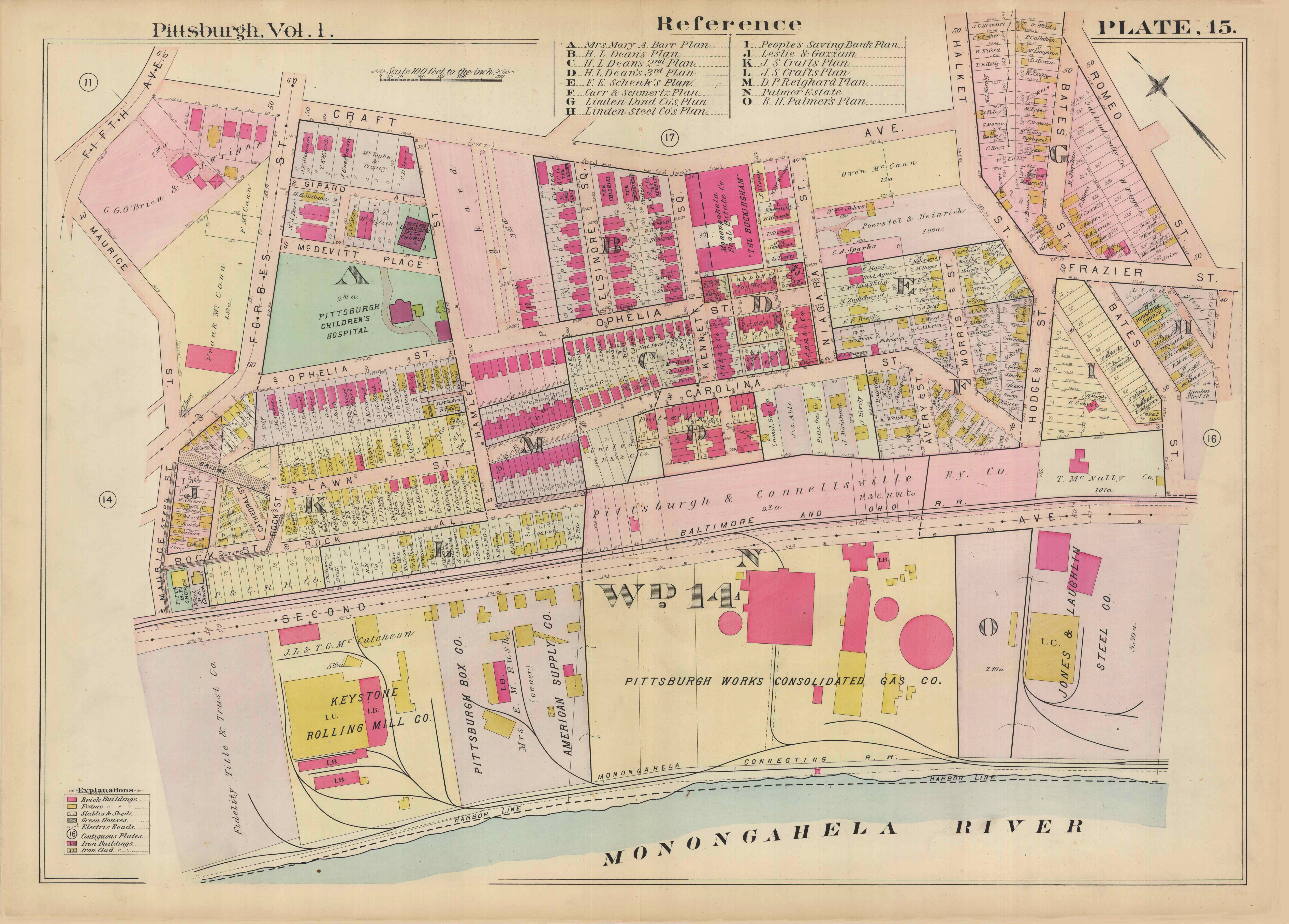
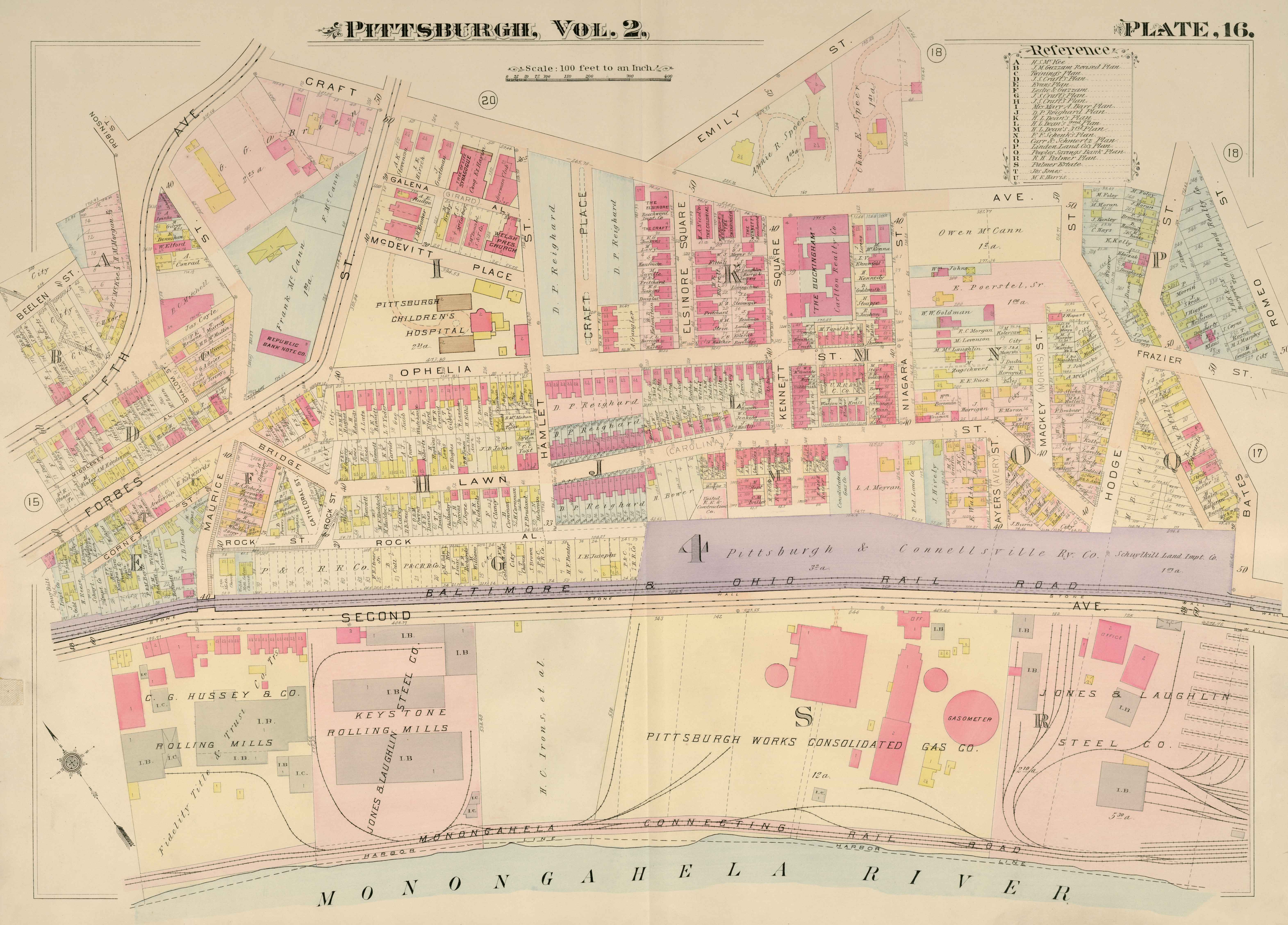
Maps of Oakcliffe
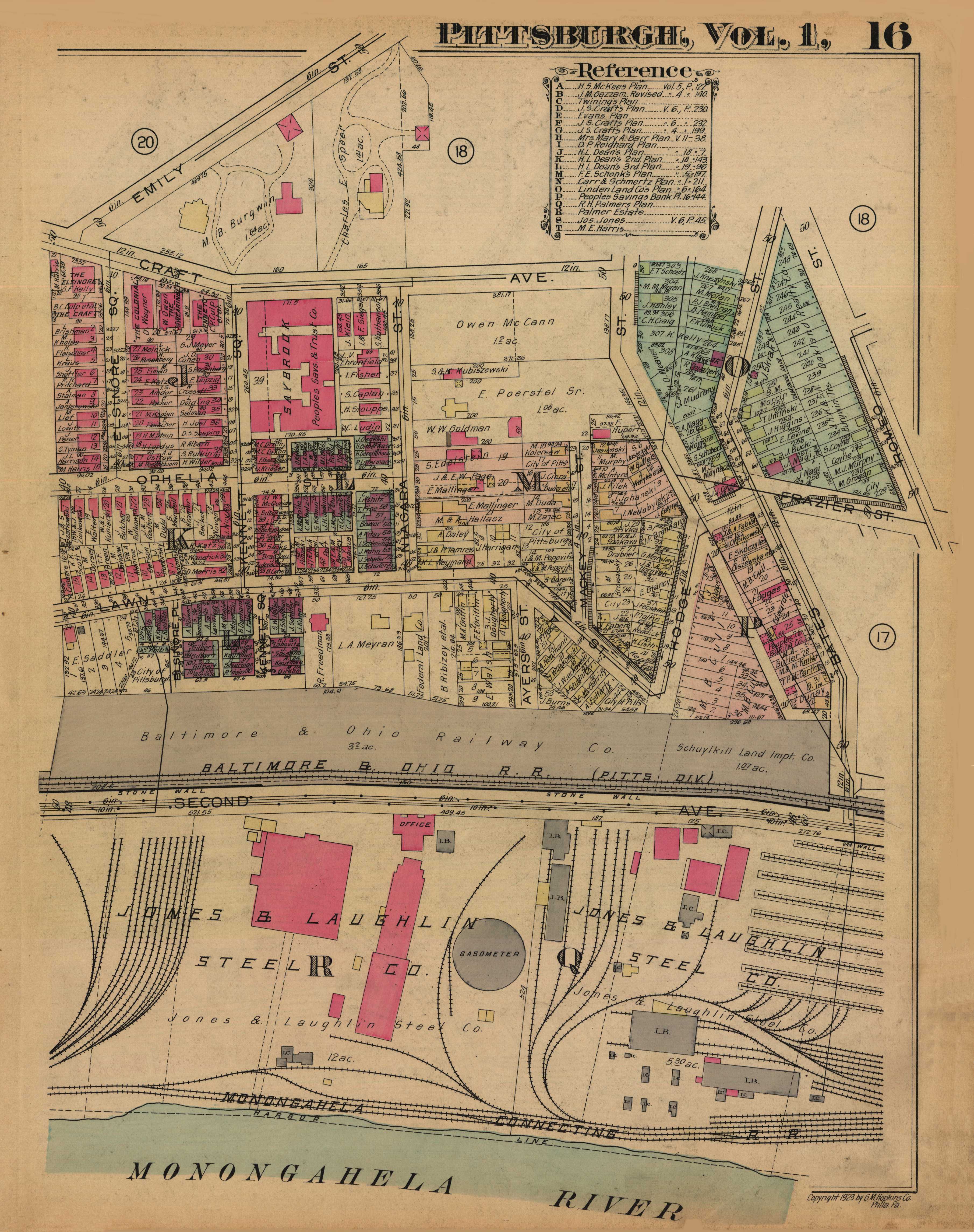
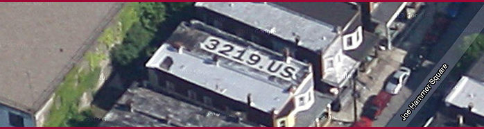
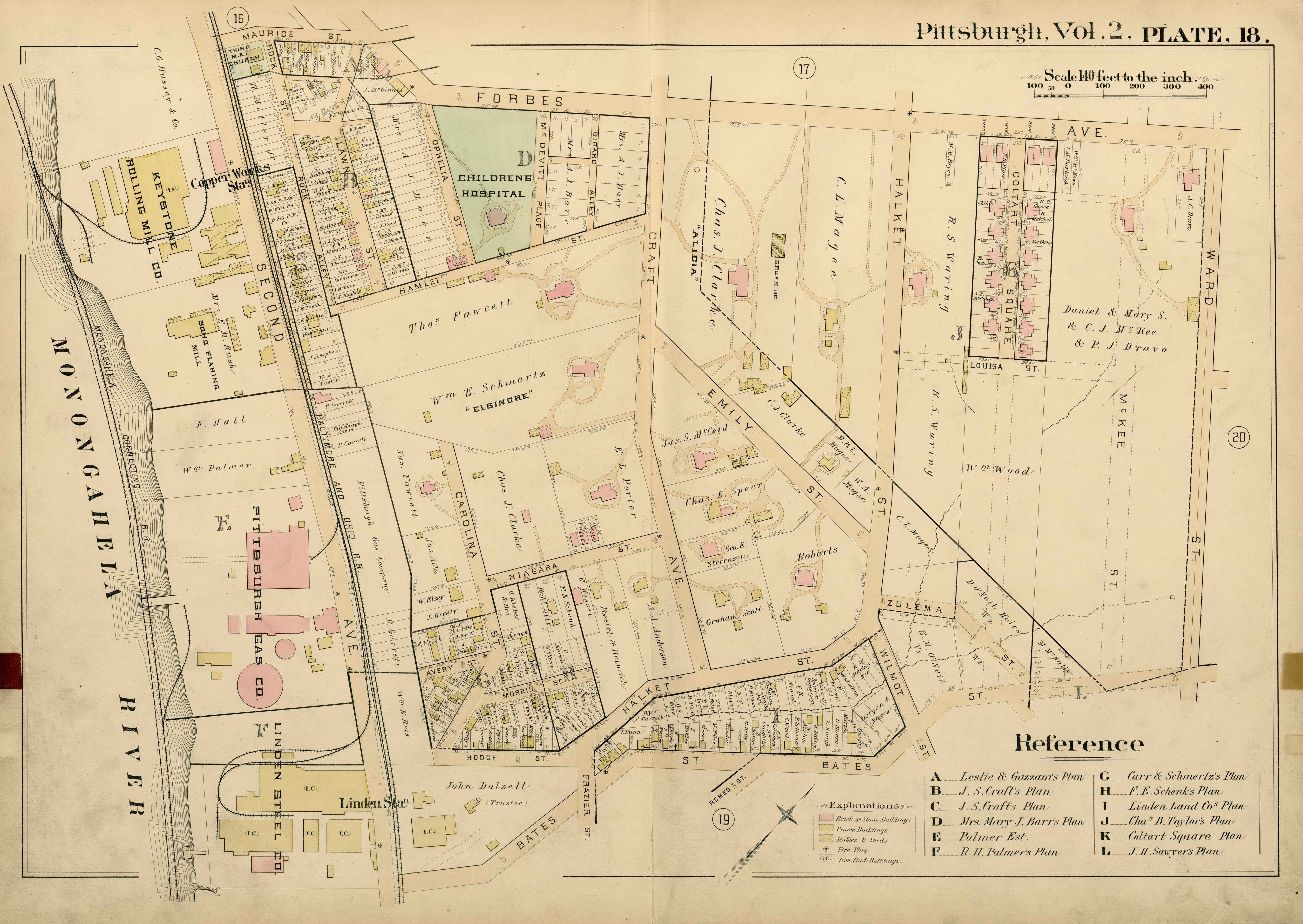
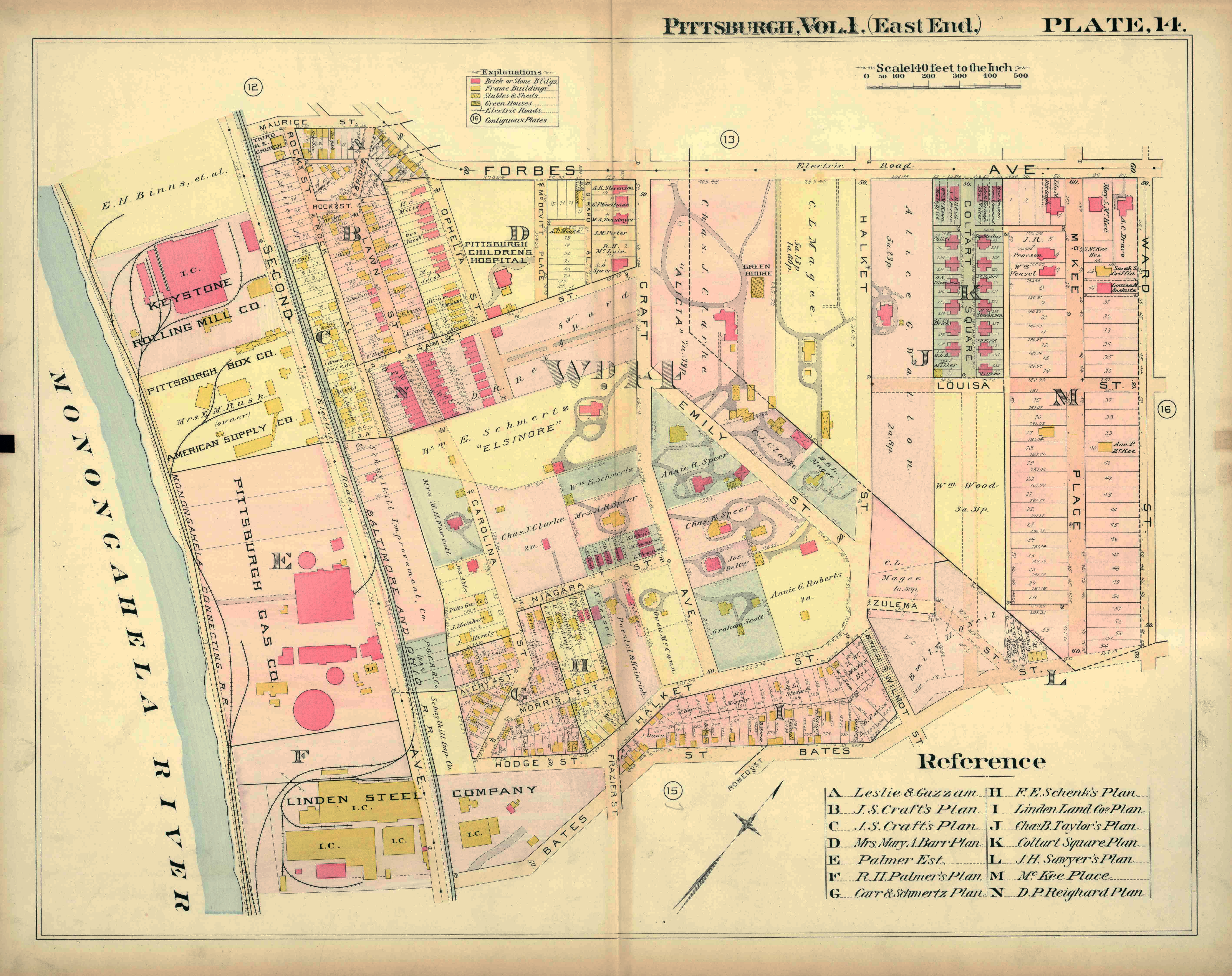
These early maps show the development of the land of 3219 Joe Hammer Square from the time it was one large estate, through its subdivision into individual homes. One can see that Elsinore Square was built after the 1889 map was drawn. One can also see the historic street Rock Alley, the subject of another one of my sites, RockAlley.org, a street removed by 1923.
These maps were downloaded from the Pittsburgh Library system.
https://historicpittsburgh.org/collection/western-pennsylvania-maps
1889
1898
1904
1914
1923